Rome was not ridden in a day


Thursday, April 3, 2008

A few scenes from the past.

These are some pics of CP on his 1970 Electraglide. The lake pics were at Greers Ferry Lake and were taken about 1979. I dont remember the location of the low water bridge although I'm sure it was on the same ride.


A pic of me from the same ride.

Monday, March 3, 2008

Morrilton-Solgohauchia Ride 2008

It started out to be a nice day for riding Sunday, the temperature was 67 when I left the house at around 1030. I did some errands in the Russellville area then headed towards Morrilton. I rode Hwy 64 East then made a right on 113 at Blackwell for a ride past pecan trees and through the soy fields that dominate the area.


This is what remains of a structure that once stood here. Its bigger than it looks in the picture. The square piece of cement with rerods is probably 3x3 ft. It may have been a tower of some kind, I know its been there for as long as I can remember.


A few hundred yards farther was this old barn. Thats Petit Jean Mtn in the distance.


When I arrived at the Point Remove Creek Bridge I was surprised. They've built a new bridge! I did'nt see anything wrong with the old bridge, I guess they needed one for bigger trucks to cross. The bridge which has been the crossing point since I've been driving has been torn down.
Here is the Old bridge, it was given a new paint job several years ago.


These summer pics are from a past ride.


The stats of the old bridge.
Overview
Through truss bridge over Point Remove Creek on AR 113 west of Morrilton
Location
Conway County, Arkansas
Status
Open to pedestrians only
Future prospects
Preserved
History
Built 1926 by the Virginia Bridge & Iron Co.; bypassed ca. 2005
Builder
- Virginia Bridge & Iron Co.

Design
Riveted, 6-panel Pratt through truss
Dimensions
Length of largest span: 122.0 ft.
Total length: 271.9 ft.
Deck width: 18.0 ft.
Vertical clearance above deck: 14.0 ft.

This is the absolutely beautiful new bridge....


This is a pic of the new bridge from the preserved bridge, looking North.


This is looking South from the old bridge.


I suppose the catfish were biting, whether they were or not did'nt seem to matter to this man.


I left the bridge behind and headed on to Morrilton. I passed by the rusting old Morrilton water tower.


A little ways down the road I took a pic of the renovations to the old St. Anthony's Hospital. I had posted some pics of the delapitated building last year and was wondering what its fate would be. What happened is a a private contracter bought it and turned it into an appartment complex.
Heres some pics of before and after. A definite improvement and a great way to save a great old building.


I arrived at Zach's a few minutes later and we agreed to ride North for about a 50 mile round trip. We headed North on Hwy 9. At the junction of 9/287 at Solgohachia we stopped at a little monument which I suppose is of area significance. I have my doubts about this story. They dont mention on the stone what tribe Chief Pontis belonged to or even the year he was chief. I'll have to do some research and update at a later time.

It looks like a tornado came through here. I cant remember it happening but it sure has the looks of it. Behind Zach you can see the renants of a little building that went along with the monument. In the distance you can see two other destroyed buildings. I like the way they put the state of Arkansas in the monument, pretty good work.
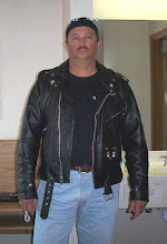
This pic is looking South down Hwy 9, thats Zach on the Heritage.


From here Zach and I took 287 North till we reached 95 which we took South back to Morrilton. The ride had turned misty and a little cooler so we stopped at Love's truck stop at I-40, and had us some hot drinks. Afterwards, I went West and Zach East, it was a good ride. I'm looking forward to alot more.

Monday, February 11, 2008

Whatwasit

Here are two pictures to a mystery. This little building is off the South side of Hwy 64 between Pottsville and Atkins. It has been there since, well, its been there as long as I can remember (which is a long time :)). What was it, I have no idea. I think maybe it was something to do with an Electric Company a long time ago, or maybe the railroad (which is just down the hill from it). I'm not sure though, it may have been used by an individual for some reason. I'm not sure if anyone reading this can remember but just to the West stood two houses on the South side of the road, one big and one little and they both were built to look the same. They looked like an adult home and a childs home. It was really strange. They're gone now though. I wish I'd taken a picture.

Sunday, February 10, 2008

Tornado Run

The first post of 2008, imagine that. The weather was nice yesterday so I went for a ride to look at all the devastation caused by the tornado that took a Northeastern run across Arkansas. The area I looked at was South and West of Atkins. The damage was considerable to say the least. Alot of the houses that were destroyed have now been piled up so the oringinal look I didnt get to see but still what is left was bad.

The Union Grove Church is still there, kind of, it hasnt been totally cleaned yet. You can look Northeast and Southwest and see the swath that tornado took to get there. It looks as if the trees had their tops cut off with a huge weedeater and other were just twisted and split in odd shapes. Tin was wrapped around trees, fences and other buildings like it was so much thin aluminum foil. Huge trees were uprooted and others looked like a giants foot had stepped on them as it was traveled Northeast.

Its really strange how the houses within feet of the swath of destruction recieved little or no damage, if they were not in the path of the giant weedeater they were safe. I saw the Red Cross, the Salvation Army and hundreds of volunteers helping with the cleanup.

The Union Grove Church goers were lucky in a strange way. Next door, within maybe 50 ft of the Church was the church nursery, which was being used at the time. I heard there were guite a few children in the nursery when the tornado struck. The Nursery though was undamaged.

As far as Motorcycles go, there were alot out yesterday, several groups were touring the area and alot of singles, myself being one.


This is a pic from the East side of Crow Mtn. If you zoom in, you can see Lucky Landing in the distance where the smoke is.

Looking East at I-40. Zooom in and you can see the front of the Union Grove Church to the left of the Interstate.

This is a closer look at the front.

This is where I crossed I-40, the South and East side of the Church. In the forground you can see the Nursery where several children were during the storm. It was untouched.

This is the North side of the Church.


This is a picture near the Feed Mill on Hwy 64. The tornado crossed the Hwy just East of the Mill. The direction the camera is looking is the direction the tornado came from.

Saturday, December 8, 2007

In planning stages

I suppose I'm going to need to take a Christmas vacation from my blog around this time each year. I have had too much going on to continue everyday and I've been putting it off. I want to do it but I just don't seem to find the time. I'll pick it up again soon after Christmas.
Merry Christmas and a Happy New Year to everyone. May the spirit of Christmas be with you this year, whatever your religion may be or not be(and may Dallas not be in the super bowl please).

Monday, December 3, 2007

Petit Jean, Part 5

When leaving Petit Jean to the West you have several choices of routes to take. You can keep on going West on 247/154, then make a choice of cutting off on 247 S, 155 N or on to Hwy 7 at Centerville. If you make a right on 155 it will take you past the turn off to the Holla Bend National Wildlife Refuge.
You can also make a left on 155 S before leaving the mountain. This will give you the choice of making a left on Hwy 324 and on to Hwy 10 or staying on 155. Either way is a good ride and the two are my choices for nice scenic rides. Hwy 155 S will take you over a narrow bridge (cant remember the name of the bridge or creek), then on to Hwy 10. Hwy 10 is a well surfaced, wide road.

This old barn is on Hwy 247 SouthWest of Petit Jean State Park.

Both of these old houses are on Hwy 155 SouthWest of the park. The one with the John Deere in the shed is still there, but the John Deere is gone. Maybe someone borrowed it, who knows, but it looked like it had been there for years.

Sunday, December 2, 2007

Petit Jean, Part 4

A little further West is this old cabin, if I'm not mistaken, I believe it was built in 1815.


Just a little further past the cabin is the old CCC Water Tower. Looks kind of like part of a castle doesnt it? Until a few years ago, you could go inside and climb the rocks. Not something I would have recomended though, it was dangerous to say the least.


My daughter and I on during one of our rides to the car show.