Rome was not ridden in a day


Thursday, October 7, 2010

Ride to Muskogee, Ok. and BBBQ 2010

Friday Oct. 1st I loaded up and headed to Muskogee,Ok. where I was to meet my Daughter Shanna. From there on Sat. we would drive to BBBQ.
I'd would first like to say that some of these pictures are not that great, I had made up my mind to get to Shanna's house before dark. I left Russellville at 11 am, I thought that would be eary enough.
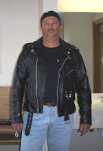

I rode down I-40 to the Hwy 23 (pigtrail) exit. I went North up the trail. Motorcycles were everywhere. I immediatly got behind a foot dragger (definition: a motorcycle rider that cannot ride slow without having their feet down, can't go into a curve without hitting the brakes, wobbles when getting started from a stop, etc. etc.). At first he was comical but then he started swerving to the other side of the road in curves so I accelerated and left him behind in a cloud of pinecones. When I arrived at Tyler Bend there were probably 150 to 200 bikes there. I wish I taken a picture but I had a long ride ahead of me. The above pic is at a restroom break on the trail.

They have straightened out several curves along the trail since my last ride there.


Doing so has created some scenic views.
This one wide spot will probably be made into a scenic pullover.

There were hundreds of bikes along the trail.

This is on Hwy 16, to continue on Hwy 23 you must go for a short distance on 16 then go North again.


Back on the trail. This is a cabin just off the Hwy.

I finally arrived at Eureka Springs. The town was absolutely filled with Corvettes and motorcycles, traffic was at a crawl. There was a Rally going on at Eureka Springs Harley Davidson. I made one stop on the Northern edge of town at the Train Depot.

Letting my bike and rear end take a breather. You can see by the no parking signs that I always follow the rules.

There were still bikes coming by but not as crowded as downtown.

This thing spins in a circle.

After leaving Eureka Springs I continued on 23 North. When I got into Missouri, I made a left on hwy 86. I followed it for a ways then took Hwy F, which is a shortcut to Hwy 112. F goes through the Mark Twain National Forest and is a beautiful ride, nice curves, deep valleys and scenary. I eventually arrived at the Roaring River State Park.

This is a park I would like to come back to. Nice camping area in the valley between mountains and along the River. They also have a State run Inn.
Leaving the park I continued on Hwy F until I arrived at Hwy 37, my next turn. I know I should have written down the directions on my hand, I didn't. I made a left turn, thinking that, well, I should go South not North, wrong. By the time I came to the Ark. state line I'd already driven at least five miles and I was not going back. If I had went back, and went North on 37 I would have made a left on 90 and followed it all the way to Ok. through the mountains and missing all the traffic. I wish I'd turned around. I ended up in Gateway, Ar. and followed Hwy 62 and the traffic jam for the next hour and a half through Rogers.
I made a stop at the Airport in Rogers. Being Air Force, I could not bypass this display of the F-101B Voodoo.


I ended up spending a lot of time at the display. I met a man named Bill here who was waiting on his Brother to show up. He was ex Air Force and we shared a lot of stories.

I entered Oklahoma at Maysville, Ar. on Hwy 20 and not long afterwards came up on this Historic marker out in the middle of the flat land.

This is the other side of the road from the marker.

I can't remember the name of this town but I stopped to take a picture to show that I wasn't too far into Ok and the Sun was going down and it was getting very cool outside.
Right now I can't remember the name of the town but I was about 70 miles from Shanna's house. I arrived at 9 pm. The entire day, I had a bowl of oatmeal and some tea, half a 20 oz. bottle of Mt. Dew and a Milky Way bar. I was starving, thirsty, cold and tired. Shanna took me to the Sonic where I bought the biggest burged they had. Tormorrow, BBBQ.

BBBQ 2010 Wednsday


The BBBQ 2010 started off with beautiful weather on Wednsday. It was a little cool in the morning when Zach and I went to Fayetteville but during midday it was perfect. We took the boring route there, I-40 and I-540. We had never been there on the first day of the event. Not many people had arrived yet and many of the vendors were still sitting up. It was still fun though and different not having to push through crowds.
We ate at "A Taste of Thai" up on the hill in old Fayetteville. I like trying out new Thai Restaurants. Zach and I had two different meals. Pad Thai and Yellow Curry and Chicken. All I can say is don't eat there unless you have been there enough to know what is good. I know a lot about Thai food and this was not good Thai food.
Want good Asian food that is not the American Chinese junk food you get from most Chinese Restaurants? Then go to Vientiane in Danville, Ar. at the junction of hwy 27 and 10. Awesome food made by Asian people.
Anyway, Zach and I walked around awhile and decided to leave to get home before dark.
One more thing. Fayetteville had implemented a new way of making money off the BBBQ attendees. They have numbered all the parking spots close to Dickson St. and are charging for people to park. If you want to park in one of the spots on Dickson St., the charge is $5. to $10. a day.


Add Image

Friday, September 17, 2010

Cannonball Run

I thought I would post this website. I may as well since I haven't been going on any rides do to work and have nothing else to post. This is a run of old motorcycles that came through Arkansas on its way to Santa Monica, Ca. If you highlight all the pics with your curser as you scroll down, you will eventually find one that is a video, a good one.

http://www.motorcyclecannonball.com/

Wednesday, July 21, 2010

Mayflower to Conway

I made a visit to the VA on Tuesday. I'd taken Hwy 9 and 10 to get there which made for a more enjoyable ride than going I-40. Finishing up at the VA I decided to take a different route home.
From I-430 I took the Hwy 100 exit to Maumelle, I made a left on Hwy 365 North somewhere along the way. At the Pulaski/Faulkner County line I noticed a memorial beside the road, they even had a picnic table there.
I had never taken any pictures of a War of 1812 heroe memorial so I took two.

This one so you can read it better. I thought it was interesting, of course I'm just a history type of guy. Heres a link http://www.encyclopediaofarkansas.net/encyclopedia/entry-detail.aspx?entryID=2872 .
When I arrived at Mayflower I made a left turn on Hwy 89. If you look at a road map you may notice that it doesn't say that 89 is paved all the way to Conway. It is all paved except for about four miles according to a local I talked to. I went to the end of the pavement and the gravel was deep, this was the only time that I have ever turned around when getting to dirt or gravel. It would have worn me out in the heat of the day and besides, I got a new front tire on.

The next four pictures are of a rock formation I found along the county maintained portion of the road.
I had to drive on about a quarter mile of gravel on Easterwood Point Road to get to the rock, but this gravel was well packed. I'm thinking this rock is called Easterwood Point...just guessing.
This picture does a better job of showing how large it is.
This is a private road in the area. The pic below is just to the right in this picture.
I thought this was nice looking for a swampy area.
When I reached the gravel and turned around, I thought I would need to go all the way back to Mayflower. Along the way back I noticed a road to the North called Rocky Gap Road going in the general direction of Conway. I followed it to "Old Military" Road then made a left on "Donnell Ridge" Road then a right onto "McNutt" Road which turns into "Hogue Ln". Hogue Ln is the road that cuts through the mountain at Conway. Hogue Ln is on the West edge of Conway which was a good thing. I stopped at Plummerville and rehydrated then took I-40 towards home.

Monday, July 19, 2010

It was cool


I stood on the front porch and the sky was overcast and the air was cool, I had mowed the lawn the previous evening. So what was there to do but go for a morning ride.


This is the Pottsville I-40 intersection and new Hwy 247 truck route. I still haven't quite figured out how they're going to do the crossroads, thats hwy 64 just beyond the I-40 bridge. Looks to me like they'll need to raise 64 a little and put in some traffic lights. It doesn't look like the new road is going over 64.

I ended up at Dardanelle Rock. Morning riding is exhilarating, wakes one up, gets the cobwebs out.

Sunday, July 18, 2010

Northwest Arkansas and Missouri

This trip into Arkansas's Northwest didn't take much planning. It was more a spur of the moment thing. I headed North on Hwy 7 into familiar territory and then the trip took a change for the better. I took the turnoff to Deer and made a right to Alum Cove Natural Bridge. This is designated as Hwy 327 now. The last time I was on it, it was just a county road and half of it was dirt. It goes to Parthenon, Ar. and now it's paved all the way and is a beautiful, winding, mountainous road. It should end up being well liked by sightseers and bikers when it gets a little more well known.

This is the mailbox of an old house between Alum Cove and Parthenon, it looked neat so I stopped and tooks some pics.


Above is the same mailbox, only about 7 years earlier when the road was still gravel. It was rough riding on that stock Honda seat.
Probably had a nice front yard years ago.


This is how it looked 7 years ago.


The roof is on its last shingle. See the central fireplace that was probably a feeble attempt to heat the entire house in Winter.
So I'm assuming by the degradation of the place over 7 years, the house had probably not been abandoned long when these older pics were taken.

Nice design on the sofa, I wonder how many abandoned dogs have slept on it.

The fireplace inside. This is as far as I went, the floor had already gave way in much of the house so I didn't take the chance.
Another archive pic, this is Parthenon, Ar. There is actually a little more to it and as usual, I wish I'd stopped and taken a few more pictures.
One last archive picture, this is after leaving Parthenon and entering the valley.

I would suppose this is the Little Buffalo River valley since that is what cuts the bluffs thru here.

Nice cattle land, the river is in the distance.

These are some white bluffs.

Just to the East of the white bluffs are some rusty ones.


This strange local asked me if I could play a Banjo and tried to grab me, I left in a hurry.


After taking a right onto Hwy 74 then a right on 7, I arrived at Jasper. This is the Newton County Jail.

Newton County Courthouse in jasper. The Court House, Jail and other buildings in Jasper are built with the same color of grey stone. I can't think of another town that uses this color of stone. There are alot of towns in which brown sandstone is used. I suppose Jasper has a quarry nearby that has this stone.

After having a World famous Ozark Cafe Burger, I sat outside for awhile. Lots of bikers were on the road. This group was from Oklahoma City. They had travelled down the Pigtrail (Hwy 23) and then came up Hwy 7. I believe they said they were headed to Branson.

I like this shade of blue. Shotguns look good.


After leaving Jasper I headed on up Hwy 7. Coming to old Dogpatch USA, I thought I would go up and see if the Hub was in business or not. It was not, looks like the only thing going is the motel. The picture above is another business that was once on the famous slab of pavement.


After passing thru Harrison, I continued North on Hwy 65. Crossing into Missouri, I took Hwy 86 to the West. I'd heard alot about this road. I heard it was curvy and kind of roller coaster like in spots. It was definitely all that and more. A very scenic road, that also has attractions. Above is the bridge across Lake Tallycomo.

I stopped on the bridge and took this picture. The lake was crowded.
One other thing I found out....I wanted to go down and look at the Big Cedar Lodge. There was a sign on the way which read - Motorcycles - do not even think about taking this road. It didn't sound very biker friendly.
I took the turnoff to Eureka Springs and it was a busy place, I didn't stay. I just continued on down Hwy 23.

After taking Hwy 12 South I came to the Hobbs State Park information center. I went in for a few minutes then hit the road again, it was almost 5pm and the War Eagle store closes at that time. Too late, the store was closed as well as the bridge for repairs (bridge is supposed to reopen by Sept. 30).

If you double click the above pic, you'll see a deer running across the field, between the nearest tree and the one to its right.

These people were not very safety conscious. I would never break a safety rule :). Actually this time I really didn't. Night was getting closer, needed to get back on the road.


This Goose was nesting just above the water wheel on the mill.

Next few pictures are of an old store at War Eagle.


After getting back on Hwy 12 for a ways, I took Hwy 45 South and eventually 23 South to Huntsville. Stopping at the Acapulco Mexican Resuarant. I had the Acapulco, two plates, a hot one and a cold one. The hot had a cheese and a chicken Enchilada and a beef tamale with refried beans and rice. The cold one had two tacos and a tostada. More than one normal person can eat and all for $7.99. Great Mexican restuarant.


Traveling South on 23, I took Hwy 74 East towards Kingston and found this old house. This is as close as I could legally get so I just did what I could. It would be great to look around this place, do a little shoveling for old bottles and some metal detecting. I rolled into Kingston and rolled out. I like the town and usually stay awhile but didn't hang around, the day was getting long.
When I arrived at the intersection where Boxley Valley begins. Ponca is left and Clarksville right. There were cars pulled over to the side of the road looking at Elk. In the above pic are two bulls, small one on the left while the one to the right had huge antlers.
I made a left towards Ponca and saw a couple more.


Buffalo River looking downstream, water was at 3.5 ft.

Upstream.

After looking at the river, I went back toward Clarksville thru Boxley Valley. Here are two more bull Elk munching on some grass.

At first I thought the cow Elk on the left had a calf, but thats a deer. I didn't see any calves. Probably saw about ten Elk total.


There just aren't many places on Earth prettier than Boxley Valley. There is something about the valley, it has an air of serenity. If I could retire here I'd be a happy man. I actually have more pictures of the valley, they're in my archives. I like all the old houses along the road.
The trip home down 21 was uneventful, arrived at the house around 9 pm. The end to a perfect 12 hour day in the beautiful Ozark Mountains.