On this ride I decided to go West on Hwy 22 to Midway, then 109 North. After arriving at Clarksville I took Hwy 64 East through town. I took Hwy 123 East next then shortly before reaching 64 again I took some county roads and ended up East of Lamar. I then took 64 back to Russellville.
A couple of old houses along Hwy 22.

Abandoned house in the cow pasture.

This house had what appears to be a gravity fed water system.


Interesting how they planted the big tree at the corner of the two sections of this house.

New Blaine... I never gave the place much thought, until now. Actually I have never gotten off Hwy 64 until now. I took Old Hwy 22 (its not called that, it has a name but I forget what they call it now) and found that it is probably the best preserved section of old Hwy 22 between Dardanelle and Ft. Smith.

The Lassiter Gas Station, Established 1935 is on the old section of road. Its a small building as were alot of gas stations in the old days. They were'nt convenience stores, they sold gas and oil.

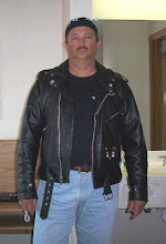
Cindy next to the old road, I took this pic to give an idea of the size of the station.

When exploring old towns, you never know what you might find. Directly across from the old station was a dirt road. I just happened to notice an old sign that said something about a museum. On one side of the road was the old New Blaine Railway station with a caboose to boot.

I'm thinking this museum is not going to be open for business.

The old Farmers State Bank.

With whittling chair out front.

Inside is quite a collection of antiques. Too bad I could'nt go inside.

Around back was interesting as well. Zoom in on those old wagons and the old truck.

Going back out on the same road I made a right at the station. The bridge across Little Shoal Creek was built across old Hwy 22 in 1929.


Looking South you can see the new Hwy 22 bridge.

Looking North, I never knew this creek was this big.

I crossed the bridge, new Hwy 22, and still following old 22 I went up the hill to the old Rollans Cash Store (which is for sale, and the price includes two houses). From the store old 22 curves around and meets up with new 22.

The New Liberty School House about six miles East of Midway.

I went on to Midway and couldnt find anything interesting to take a picture of there. So it was on to Scratton, I probably missed something interesting at Scranton but it was getting late and I was hurting for sunlight.

Saint Peter and Paul Catholic Church is at Morrison Bluff. I'm not sure what year it was established but it was certainly the most dark pink church I ever seen.
Morrison Bluff is where Hwy 109 crosses the Arkansas River on what is the longest bridge in Arkansas. Its right at two miles long and is a really nice drive.

 This old house is known as the Pioneer House in Johnson County http://www.clarksvillearchamber.com/historic.htm. Its located at Hwy 123/Hospital Drive in Clarksville and is the oldest documented house in Johnson County. It was built circa 1850. Its has not been taken care of, as is the case with alot of historical sites in Arkansas. I think I've said that before, and it's the truth.
Below is part of an area I've always known as 40 acre rock.

I don't know how many acres of rock there really are here but I'm sure its at least 40 acres. Not too many years ago there were only a couple of houses in the area and the trees were all short from fire, logging or whatever. The area was a real eyecatcher. When I was a teenager I climbed all over these rocks. Of course now there is a housing area and most of the rocky area can't be seen from 64 or I-40.
Heres how to get there. Going West from Russellville on 64, cross the lake, turn right as if to get on I-40. Go over I-40 take a right on Dwight Mission Road and the area is on the left. I didnt see any "No Tresspassing" signs.

The house was left in the picture intentionally to show the size of the rocks. I've heard that some of the new houses here are sliding on the rock, apparently the the soil is not very deep and the houses were not anchored to the rock.
As with alot of areas in Poop County, this is another spot that was overlooked. Forty Acre rock could very well have been made into a park/natural area. I guess we already have too many parks, natural areas, museums and preserved archaelogical sites in the county. We would'nt want to attract to many of the wrong kind of tourists, right. Lets keep it simple. Remember, the family that fishes together stays together.
I hope someone from the area understands my sarcasm.